Why Signal Loss Happens Faster Than You Expect
You're two miles into a trail and your phone shows one bar. Another half mile and it's gone entirely. This scenario plays out for millions of American hikers every year, and it catches even well-prepared people off guard. Cell coverage maps are optimized for roads and population centers — not ridgelines, canyon floors, or dense wilderness areas.
Terrain is the biggest culprit. Hills, cliffs, and dense tree canopies block radio signals, and the deeper you travel from a cell tower, the faster coverage degrades. Battery drain accelerates when your phone hunts for a signal in a weak-coverage zone, which compounds the problem quickly.
This is why outdoor navigation is a layered skill, not a single tool. Whether you're a first-time camper (see our beginner camping guide for more on preparation) or an experienced backpacker, understanding map, compass, and GPS as a system — rather than relying on any one of them — is what keeps you oriented when it counts.
Reading a Topographic Map: The Foundation of Land Navigation
A topographic map (often called a "topo map") uses contour lines to represent three-dimensional terrain on a flat surface. Each contour line connects points of equal elevation, so when lines are tightly packed together, the terrain is steep; widely spaced lines indicate gentler slopes.
Key features to recognize on a topo map include:
- Contour interval: The elevation change between each contour line, printed in the map legend. Common intervals on US Geological Survey (USGS) maps are 20 or 40 feet.
- Index contours: Darker, labeled lines that mark major elevation benchmarks, making it easier to count your way up or down a slope.
- Water features: Streams, lakes, and seasonal drainages shown in blue — invaluable landmarks for orienting yourself.
- Trails, roads, and structures: Marked with standardized symbols explained in the map legend.
USGS produces free downloadable topo maps for the entire United States through its National Map portal — a reliable starting point before any backcountry trip. Print or download them ahead of time; don't count on downloading them once you're in the field.
Always orient your map to the actual terrain before reading it — rotate the map so north on paper matches north in the real world, then use visible landscape features to confirm your location before moving.
Most navigation errors happen when people read a map in isolation from their surroundings. Ground-truthing the map to the landscape eliminates the most common source of backcountry disorientation.
Write your declination adjustment on the back of your printed map with a permanent marker so you never have to look it up mid-hike.
Declination errors compound over distance. Having the correction instantly accessible prevents the mental arithmetic mistake that can send you significantly off-course over a long day of travel.
Using a Compass: More Than Just Pointing North
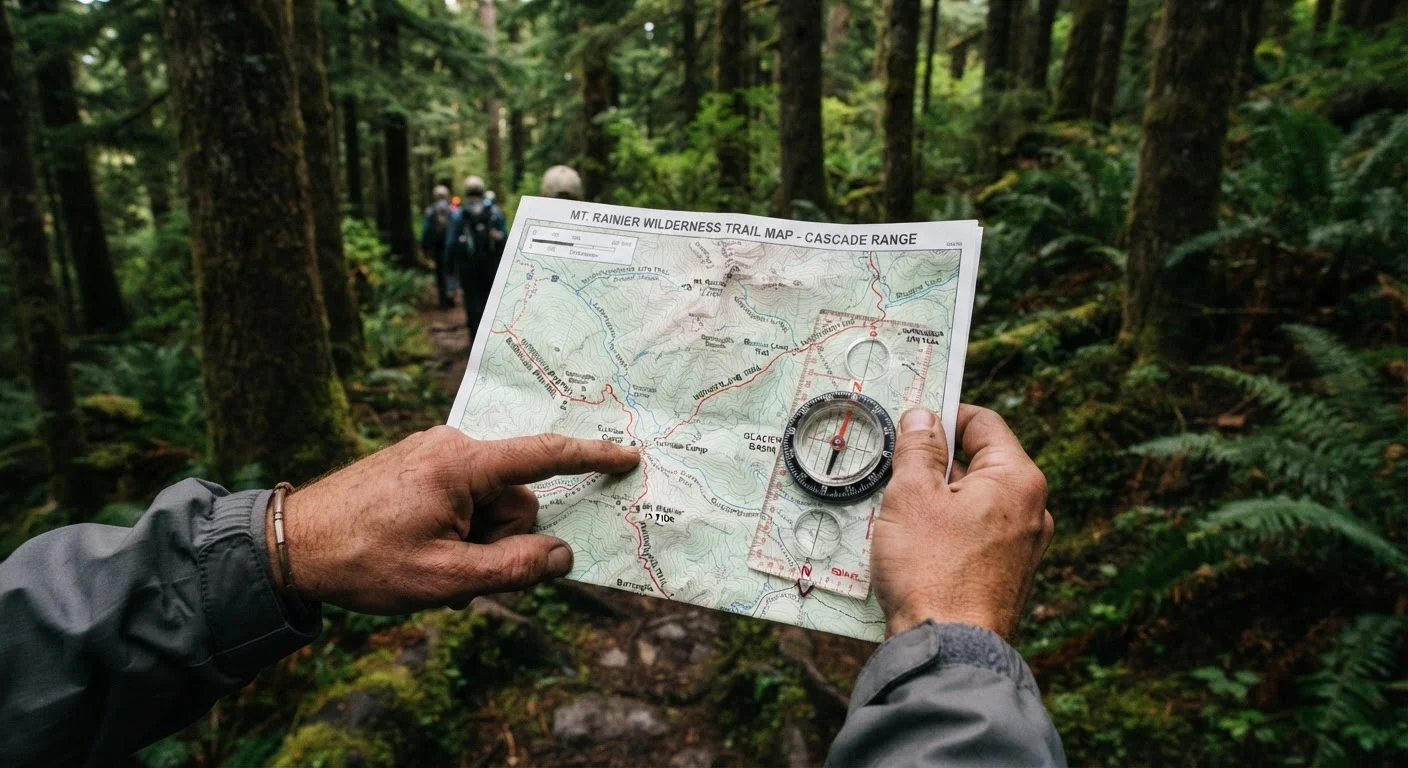
A compass tells you direction, but its real power comes when you combine it with a map. The standard tool for land navigation is a baseplate compass (also called an orienteering compass), which features a transparent rectangular base, a rotating bezel marked in degrees, and a magnetic needle that always points toward magnetic north.
Declination: The Detail That Trips People Up
Magnetic north and true north are not the same. The angular difference between them — called magnetic declination — varies by location across the US, ranging from roughly 20° west in Maine to about 15° east in parts of the Pacific Northwest. Ignoring declination when navigating over long distances leads to meaningful directional errors. Topo maps printed by USGS include a declination diagram; adjust your compass bezel or your bearing calculation accordingly.
Taking a Bearing
Place your compass on the map, align the edge between your current location and your destination, rotate the bezel to align with map north, then hold the compass level and turn your body until the needle sits within the orienting arrow. The direction of travel arrow now points toward your destination. This process — called taking a bearing — is a fundamental skill worth practicing until it becomes second nature.
GPS Devices and Offline Apps: Digital Tools That Work Offline
GPS technology uses signals from satellites orbiting Earth — not cell towers — so a dedicated GPS device or a phone with pre-loaded offline maps can function perfectly in areas with zero cell coverage. The key distinction is pre-loading: satellite-based positioning works anywhere with an open sky, but map tiles and route data must be downloaded before you lose internet access.
Dedicated GPS Units
Handheld GPS devices built for outdoor use are rugged, offer long battery life (often using AA batteries you can swap in the field), and come pre-loaded with topographic maps. They typically acquire satellite signals faster and more reliably than smartphones in difficult terrain.
Smartphone Offline Mapping Apps
Several reputable mapping applications allow you to download detailed trail and topo maps for offline use. Download the specific region you plan to visit while you're still on Wi-Fi, and verify the download is complete before your trip. A phone running an offline map still burns battery faster than a dedicated GPS unit, so carry a backup battery pack.
This contrasts with urban navigation — where apps rely heavily on live data and cell connectivity, as explored in our piece on navigating public transit in unfamiliar cities. In the backcountry, there is no live data fallback, which is exactly why offline preparation matters.
How to Use All Three Tools Together
Experienced navigators treat map, compass, and GPS as a triangle of redundancy. Each tool has a weakness the others compensate for:
- Map weakness: Doesn't tell you your current position automatically — you have to figure out where you are by reading the landscape.
- Compass weakness: Gives direction but no distance or terrain detail on its own.
- GPS weakness: Batteries die, screens crack, and satellite acquisition can be slow in deep canyons or heavy tree cover.
A practical workflow: use your GPS to confirm your current coordinates, then find that point on your printed topo map to understand the terrain around you, then take a compass bearing toward your next waypoint to maintain direction if the GPS fails. Cross-check regularly — especially when the trail becomes faint or disappears.
Triangulation is a classic map-and-compass technique worth learning: identify two or three visible landmarks on the ground, take bearings to each from your position, draw those bearing lines on the map, and where they intersect is approximately where you are. It sounds involved but becomes intuitive with practice.
Building Confidence: Practice Before You Hit the Trail
Navigation is a perishable skill — meaning it fades without use. The good news is that it's genuinely fun to practice, and you can start in your own neighborhood or a local park with no risk.
Try these progression steps:
- Map your neighborhood: Download a topo map of a familiar area and practice identifying landmarks you already know — hills, streams, roads. This builds the mental translation between flat map and real terrain.
- Practice bearing walks: Pick a visible target, take a compass bearing to it, and walk toward it using only the compass — no peeking at the destination. This builds trust in the tool.
- Do a GPS-off hike: On a well-marked trail you know, leave your phone in airplane mode and navigate using only your map and compass for the full trip. Recheck your GPS at trail end to see how accurate your navigation was.
- Try orienteering: Orienteering clubs host beginner-friendly events across the US where participants navigate between control points using a map and compass. It's competitive, social, and an excellent accelerated learning environment.
If you're introducing kids to the outdoors, building navigation skills early pays enormous dividends — our guide on keeping kids engaged on outdoor adventures offers age-appropriate ideas for making the process feel like a game rather than a lesson.
The backcountry rewards preparation. Understanding how your map, compass, and GPS work individually — and as a system — transforms navigation from a source of anxiety into one of the most satisfying parts of any outdoor adventure.